Cartography
Sub Categories
C-MAP
C-MAP MAX NA-M320 -Passamaquoddy Bay ME-NC: Bathy - C-Card [NA-M320C-CARD]
$279.00
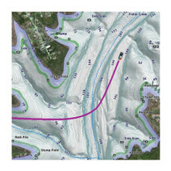
NA-M320 => Passamaquoddy Bay to Cape LookoutCoverage includes offshore bathymetric details from Passamaquoddy Bay, ME to Cape Lookout, NC. Coverage extends from the coastline out to the Atlantic Canyons - Hudson, Baltimore, Oceanographer and others. ...
C-MAP
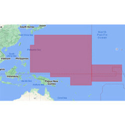
C-MAP 4D PC-D203 Carolinas, Kiribati, Marshall Marianas [M-PC-D203-MS]
$299.00
4D PC-D203 Carolinas, Kiribati, Marshall & MarianasC-MAP 4D MAX+ is the latest evolution of electronic charting technology, combining award-winning vector chart data with exclusive Dynamic Raster Charts and the ability to view charts in 2D or...
Humminbird
Humminbird CoastMaster Premium Edition - Florida - Version 1 [602014-1]
$299.99
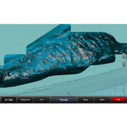
CoastMaster™ Premium Edition - Florida - Version 1CoastMaster Premium, Florida arms saltwater anglers with even more information to identify the most productive areas in all Florida coastal waters.Premium Features:2D Shaded Relief makes bottom...
C-MAP
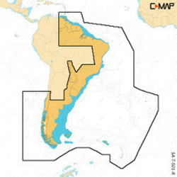
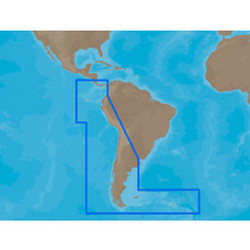
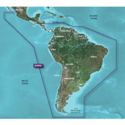
C-MAP 4D SA-D501 Gulf of Paria to Cape Horn [SA-D501]
$339.00
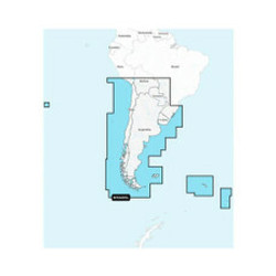
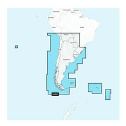
4D SA-D501 Gulf of Paria to Cape HornWith C-MAP’s detailed cartography and extensive database of local information at your fingertips you’ll never be lost, even in unfamiliar waters.Dominate the water with C-MAP’s full vector charts,...
C-MAP
C-MAP 4D NA-D065 Caribbean Central America -microSD/SD [NA-D065]
$339.00
NA-D065 Caribbean & Central America - microSD™/SD™Card Format: SD/MicroSDSoftware: C-Map 4D Specifications:Card Format: MicroSD/SDBox Dimensions: 1"H x 6"W x 10"L WT: 0.1 lbs
C-MAP
C-MAP 4D NA-D064 Gulf of Mexico - microSD/SD [NA-D064]
$339.00
NA-D064 Gulf of Mexico - microSD™/SD™ Card Format: SD/MicroSDSoftware: C-Map 4D Specifications:Card Format: MicroSD/SDBox Dimensions: 1"H x 6"W x 10"L WT: 0.1 lbs
C-MAP
C-MAP 4D NA-D061 Great Lakes St Lawrence Seaway -microSD/SD [NA-D061]
$339.00
NA-D061 Great Lakes & St Lawrence Seaway - microSD™/SD™Card Format: SD/MicroSDSoftware: C-Map 4D Specifications:Card Format: MicroSD/SDBox Dimensions: 1"H x 6"W x 10"L WT: 0.1 lbs
C-MAP
C-MAP 4D NA-063 Chesapeake Bay to Cuba - microSD/SD [NA-D063]
$339.00
NA-063 Chesapeake Bay to Cuba - microSD™/SD™Card Format: SD/MicroSDSoftware: C-Map 4D Specifications:Card Format: MicroSD/SDBox Dimensions: 1"H x 6"W x 10"L WT: 0.1 lbs
C-MAP
C-MAP 4D NA-D062 Nova Scotia to Chesapeake Bay - microSD/SD [NA-D062]
$339.00
NA-D062 Nova Scotia to Chesapeake Bay - microSD™/SD™Card Format: SD/MicroSDSoftware: C-Map 4D Specifications:Card Format: MicroSD/SDBox Dimensions: 1"H x 6"W x 10"L WT: 0.1 lbs
C-MAP
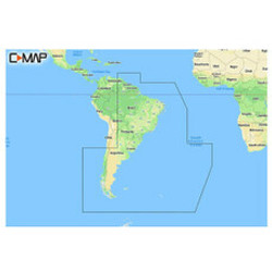
C-MAP 4D SA-D500 Costa Rica to Chile to Falklands [SA-D500]
$339.00
4D SA-D500 Costa Rica to Chile to FalklandsC-MAP charts have long been held in high regard by boaters because they combine aesthetically pleasing vector electronic charts with reliable sources. With the backing of Jeppesen's parent company...
C-MAP
C-MAP 4D NA-D025 - Canada West Including Puget Sound [NA-D025]
$339.00
4D NA-D025 Canada West Including Puget SoundFor Raymarine MFDs, Furuno, Standard Horizon and HumminbirdThe next evolution in navigation solutions. C-MAP 4D adapts to your boating needs because it's the only digital chart that offers advanced features...
C-MAP
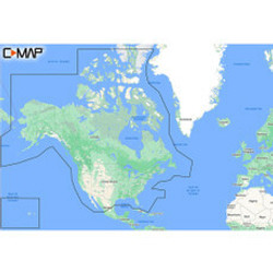
C-MAP 4D NA-D021 - Canada North & East [NA-D021]
$339.00
4D NA-D021 Canada North & EastFor Raymarine MFDs, Furuno, Standard Horizon and HumminbirdThe next evolution in navigation solutions. C-MAP 4D adapts to your boating needs because it's the only digital chart that offers advanced features and lets you add...
C-MAP
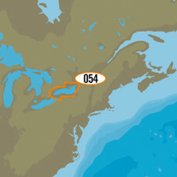
C-MAP MAX NA-M054/SD - Lake Ontario Bathymetric SD Format [NA-M054/SD]
$279.00
MAX NA-M054/SD - Lake Ontario Bathymetric SD FormatC-MAPs extensive freshwater database offers lake detail for nearly 13,000 lakes and also includes:2,000 high definition lakes (better than 3 foot contours)Current state regulations (creel and bag...
C-MAP
C-MAP MAX NA-M053/SD - Lake Erie & Lake St. Clair Bathymetric SD Format [NA-M053/SD]
$279.00
MAX NA-M053/SD - Lake Erie & Lake St. Clair Bathymetric SD FormatC-MAPs extensive freshwater database offers lake detail for nearly 13,000 lakes and also includes:2,000 high definition lakes (better than 3 foot contours)Current state regulations (creel...
C-MAP
C-MAP MAX NA-M052/SD - Lake Huron Bathymetric SD Format [NA-M052/SD]
$279.00
MAX NA-M052/SD - Lake Huron Bathymetric SD FormatC-MAPs extensive freshwater database offers lake detail for nearly 13,000 lakes and also includes:2,000 high definition lakes (better than 3 foot contours)Current state regulations (creel and bag...
C-MAP
C-MAP MAX NA-M051/SD - Lake Superior Bathymetric SD Format [NA-M051/SD]
$279.00
MAX NA-M051/SD - Lake Superior Bathymetric SD FormatC-MAPs extensive freshwater database offers lake detail for nearly 13,000 lakes and also includes:2,000 high definition lakes (better than 3 foot contours)Current state regulations (creel and bag...
C-MAP
C-MAP MAX NA-M050/SD - Lake Michigan Bathymetric SD Format [NA-M050/SD]
$279.00
MAX NA-M050/SD - Lake Michigan Bathymetric SD FormatC-MAPs extensive freshwater database offers lake detail for nearly 13,000 lakes and also includes:2,000 high definition lakes (better than 3 foot contours)Current state regulations (creel and bag...
C-MAP
C-MAP 4D NA-D028 - Alaska - Full Content [NA-D028-FULL]
$339.00
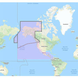
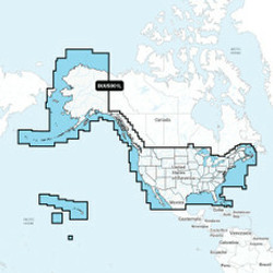
NA-D028 - AlaskaCoverage of the southern Alaska coast from Dixon Entrance up and over to Kodiak Island. Includes all of the Aleutian Islands out to Attu Island, Bristol Bay, and the North Slope over to Liverpool Bay in the Yukon Territory, Canada...
C-MAP
C-MAP 4D NA-D024 - USA West Coast & Hawaii - Full Content [NA-D024-FULL]
$339.00
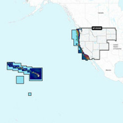
NA-D024 - U.S. West Coast to Mexico and HawaiiCoverage of the Pacific Coast of the United States, including all of the coasts of California, Oregon and Washington. Coverage of Baja California and Mexico down to Puerto Vallarta. Detail of the Columbia...
C-MAP
C-MAP MAX NA-M320 - Passamaquoddy Bay ME-NC: Bathy - SD Card [NA-M320SDCARD]
$279.00
NA-M320 => Passamaquoddy Bay to Cape LookoutCoverage includes offshore bathymetric details from Passamaquoddy Bay, ME to Cape Lookout, NC. Coverage extends from the coastline out to the Atlantic Canyons - Hudson, Baltimore, Oceanographer and others. ...
 US Dollars

![C-MAP MAX NA-M320 -Passamaquoddy Bay ME-NC: Bathy - C-Card [NA-M320C-CARD] C-MAP MAX NA-M320 -Passamaquoddy Bay ME-NC: Bathy - C-Card [NA-M320C-CARD]](https://cdn11.bigcommerce.com/s-ge8sirtax0/images/stencil/230x230/products/37151/51637/33236XL__02349.1731441848.jpg?c=1)
![C-MAP 4D PC-D203 Carolinas, Kiribati, Marshall Marianas [M-PC-D203-MS] C-MAP 4D PC-D203 Carolinas, Kiribati, Marshall Marianas [M-PC-D203-MS]](https://cdn11.bigcommerce.com/s-ge8sirtax0/images/stencil/230x230/products/30020/39763/79105XL__26225.1678218102.jpg?c=1)
![Humminbird CoastMaster Premium Edition - Florida - Version 1 [602014-1] Humminbird CoastMaster Premium Edition - Florida - Version 1 [602014-1]](https://cdn11.bigcommerce.com/s-ge8sirtax0/images/stencil/230x230/products/23021/29720/88682XL__88101.1678009300.jpg?c=1)
![C-MAP 4D SA-D501 Gulf of Paria to Cape Horn [SA-D501] C-MAP 4D SA-D501 Gulf of Paria to Cape Horn [SA-D501]](https://cdn11.bigcommerce.com/s-ge8sirtax0/images/stencil/230x230/products/19021/24058/80867XL__66247.1677998738.jpg?c=1)
![C-MAP 4D NA-D065 Caribbean Central America -microSD\/SD [NA-D065] C-MAP 4D NA-D065 Caribbean Central America -microSD\/SD [NA-D065]](https://cdn11.bigcommerce.com/s-ge8sirtax0/images/stencil/230x230/products/16639/20873/76126XL__17778.1677992692.jpg?c=1)
![C-MAP 4D NA-D064 Gulf of Mexico - microSD\/SD [NA-D064] C-MAP 4D NA-D064 Gulf of Mexico - microSD\/SD [NA-D064]](https://cdn11.bigcommerce.com/s-ge8sirtax0/images/stencil/230x230/products/16638/20872/76125XL__09641.1677992690.jpg?c=1)
![C-MAP 4D NA-D061 Great Lakes St Lawrence Seaway -microSD\/SD [NA-D061] C-MAP 4D NA-D061 Great Lakes St Lawrence Seaway -microSD\/SD [NA-D061]](https://cdn11.bigcommerce.com/s-ge8sirtax0/images/stencil/230x230/products/16637/20871/76124XL__56127.1677992687.jpg?c=1)
![C-MAP 4D NA-063 Chesapeake Bay to Cuba - microSD\/SD [NA-D063] C-MAP 4D NA-063 Chesapeake Bay to Cuba - microSD\/SD [NA-D063]](https://cdn11.bigcommerce.com/s-ge8sirtax0/images/stencil/230x230/products/16636/20870/76123XL__71281.1677992685.jpg?c=1)
![C-MAP 4D NA-D062 Nova Scotia to Chesapeake Bay - microSD\/SD [NA-D062] C-MAP 4D NA-D062 Nova Scotia to Chesapeake Bay - microSD\/SD [NA-D062]](https://cdn11.bigcommerce.com/s-ge8sirtax0/images/stencil/230x230/products/16635/20869/76122XL__63257.1677992683.jpg?c=1)
![C-MAP 4D SA-D500 Costa Rica to Chile to Falklands [SA-D500] C-MAP 4D SA-D500 Costa Rica to Chile to Falklands [SA-D500]](https://cdn11.bigcommerce.com/s-ge8sirtax0/images/stencil/230x230/products/14264/17716/71429XL__51438.1677986558.jpg?c=1)
![C-MAP 4D NA-D025 - Canada West Including Puget Sound [NA-D025] C-MAP 4D NA-D025 - Canada West Including Puget Sound [NA-D025]](https://cdn11.bigcommerce.com/s-ge8sirtax0/images/stencil/230x230/products/10169/12717/60780XL__39672.1677976353.jpg?c=1)
![C-MAP 4D NA-D021 - Canada North & East [NA-D021] C-MAP 4D NA-D021 - Canada North & East [NA-D021]](https://cdn11.bigcommerce.com/s-ge8sirtax0/images/stencil/230x230/products/10168/12716/60779XL__62810.1677976351.jpg?c=1)
![C-MAP MAX NA-M054\/SD - Lake Ontario Bathymetric SD Format [NA-M054\/SD] C-MAP MAX NA-M054\/SD - Lake Ontario Bathymetric SD Format [NA-M054\/SD]](https://cdn11.bigcommerce.com/s-ge8sirtax0/images/stencil/230x230/products/10123/12671/60715XL__71057.1677976247.jpg?c=1)
![C-MAP MAX NA-M053\/SD - Lake Erie & Lake St. Clair Bathymetric SD Format [NA-M053\/SD] C-MAP MAX NA-M053\/SD - Lake Erie & Lake St. Clair Bathymetric SD Format [NA-M053\/SD]](https://cdn11.bigcommerce.com/s-ge8sirtax0/images/stencil/230x230/products/10122/12670/60714XL__26220.1677976245.jpg?c=1)
![C-MAP MAX NA-M052\/SD - Lake Huron Bathymetric SD Format [NA-M052\/SD] C-MAP MAX NA-M052\/SD - Lake Huron Bathymetric SD Format [NA-M052\/SD]](https://cdn11.bigcommerce.com/s-ge8sirtax0/images/stencil/230x230/products/10121/12669/60713XL__22391.1677976243.jpg?c=1)
![C-MAP MAX NA-M051\/SD - Lake Superior Bathymetric SD Format [NA-M051\/SD] C-MAP MAX NA-M051\/SD - Lake Superior Bathymetric SD Format [NA-M051\/SD]](https://cdn11.bigcommerce.com/s-ge8sirtax0/images/stencil/230x230/products/10120/12668/60712XL__05676.1677976241.jpg?c=1)
![C-MAP MAX NA-M050\/SD - Lake Michigan Bathymetric SD Format [NA-M050\/SD] C-MAP MAX NA-M050\/SD - Lake Michigan Bathymetric SD Format [NA-M050\/SD]](https://cdn11.bigcommerce.com/s-ge8sirtax0/images/stencil/230x230/products/10119/12667/60711XL__01307.1677976238.jpg?c=1)
![C-MAP 4D NA-D028 - Alaska - Full Content [NA-D028-FULL] C-MAP 4D NA-D028 - Alaska - Full Content [NA-D028-FULL]](https://cdn11.bigcommerce.com/s-ge8sirtax0/images/stencil/230x230/products/5334/6839/48115XL__99545.1677885946.jpg?c=1)
![C-MAP 4D NA-D024 - USA West Coast & Hawaii - Full Content [NA-D024-FULL] C-MAP 4D NA-D024 - USA West Coast & Hawaii - Full Content [NA-D024-FULL]](https://cdn11.bigcommerce.com/s-ge8sirtax0/images/stencil/230x230/products/5333/6838/48109XL__91736.1677885942.jpg?c=1)
![C-MAP MAX NA-M320 - Passamaquoddy Bay ME-NC: Bathy - SD Card [NA-M320SDCARD] C-MAP MAX NA-M320 - Passamaquoddy Bay ME-NC: Bathy - SD Card [NA-M320SDCARD]](https://cdn11.bigcommerce.com/s-ge8sirtax0/images/stencil/230x230/products/1787/2254/31356XL__31263.1677874053.jpg?c=1)