C-Map Max

Sub Categories
C-MAP
C-MAP MAX NA-M027 - Central America & The Caribbean - C-Card [NA-M027C-CARD]
$279.00
NA-M027 => Central America and CaribbeanCoverage of Central America, all of the Caribbean and the northern coast of South America, and the Gulf of Mexico. Coverage of the Pacific coast starts at Point Conception, CA and runs down to Bahia Cupica,...
C-MAP
C-MAP MAX NA-M022 - U.S. East Coast & The Bahamas - C-Card [NA-M022C-CARD]
$279.00
NA-M022 => USA East Coast and BahamasCoverage of the United States Atlantic coast from Passamaquoddy Bay, ME down to Key West, FL, with extended coverage into the Gulf of Mexico over to Perdido Bay, FL. Includes coverage of Bermuda and all of the...
C-MAP
C-MAP MAX NA-M023 - U.S. Gulf Coast & Inland Rivers - C-Card [NA-M023C-CARD]
$279.00
NA-M023 => Gulf of Mexico, Great Lakes and RiversCoverage of the Gulf states, starting from Boca Raton, FL, down to Key West, FL, then back up and around the Gulf to Brownsville, TX. Also includes coverage of all the Great Lakes: Erie, Superior,...
C-MAP
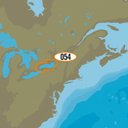
C-MAP MAX NA-M026 - Great Lakes & The Maritimes - C-Card [NA-M026C-CARD]
$279.00
NA-M026 => Great Lakes, Northeast Coast and ApproachesCoverage of the Great Lakes, St. Lawrence River and Northeast United States. Coverage of the Great Lakes also includes Fox River and Lake Winnebago, Lake St. Clair, Rideau Canal, Ottawa River and...
C-MAP
C-MAP MAX NA-M012 - Canada North & East - C-Card [NA-M021C-CARD]
$279.00
NA-M021 => Canada North and EastCoverage of the Arctic and Atlantic coasts of Canada including Hudson Bay, Newfoundland, the Gulf of St. Lawrence, Nova Scotia and the Bay of Fundy. Also includes coverage of the St. Lawrence River and eastern Lake...
C-MAP
C-Map NA-M420 Gulf of Mexico Bathy Chart - C-Card [NA-M420C-CARD]
$279.00
NA-M420 Gulf of Mexico Bathy Chart - C-CardGulf of Mexico coverage includes the offshore bathymetric details for the Gulf of Mexico from Key West, FL over and around to Brownsville, TX. Additional coverage up the eastern coast of Florida to Jacksonville...
C-MAP
C-MAP MAX NA-M621 - Cape Blanco, OR-Puget Sound - SD Card [NA-M621SDCARD]
$279.00
NA-M621 => Cape Blanco to Puget SoundCoverage includes the offshore bathymetric details for the coasts of Oregon and Washington. Coverage actually starts around the Klamath River delta in California and goes up to Cape Flattery, and around into Puget...
C-MAP
C-MAP MAX NA-M620 - San Diego, CA-Cape Blanco, OR - SD Card [NA-M620SDCARD]
$279.00
NA-M620 => San Diego to Cape BlancoCoverage includes the offshore bathymetric details for the coast of California and southern coast of Oregon, up to Cape Blanco. Complete coverage of the Channel Islands is also included. Fishing Contour Charts do not...
C-MAP
C-MAP MAX NA-M420 - Gulf of Mexico: Bathy - SD Card [NA-M420SDCARD]
$279.00
NA-M420 => Gulf of MexicoCoverage includes the offshore bathymetric details for the Gulf of Mexico from Key West, FL over and around to Brownsville, TX. Additional coverage up the eastern coast of Florida to Jacksonville is included. Some coverage of...
C-MAP
C-MAP MAX NA-M321 - Cape Henry, NC-Apalachicola, FL - SD Card [NA-M321SDCARD]
$279.00
NA-M321 => Cape Henry to Apalachicola BayCoverage includes offshore bathymetric details from Cape Henry, VA to Apalachicola Bay, FL. Coverage extends from the coastline out to the offshore Atlantic Canyons - Norfolk, Washington and others. Some...
C-MAP
C-MAP MAX SA-M501 - Gulf of Paria - Cape Horn - SD Card [SA-M501SDCARD]
$279.00
SA-M501 => Gulf of Paria to Cape HornCoverage starts at Quintero, Chile on the Pacific coast and extends south down the Chile border, wraps up around Cape Horn and continues up the Atlantic coasts of Argentina, Uruguay, Brazil, French Guiana, Suriname,...
 US Dollars
![C-MAP MAX NA-M027 - Central America & The Caribbean - C-Card [NA-M027C-CARD] C-MAP MAX NA-M027 - Central America & The Caribbean - C-Card [NA-M027C-CARD]](https://cdn11.bigcommerce.com/s-ge8sirtax0/images/stencil/230x230/products/1472/1928/30131XL__92247.1677873110.jpg?c=1)
![C-MAP MAX NA-M022 - U.S. East Coast & The Bahamas - C-Card [NA-M022C-CARD] C-MAP MAX NA-M022 - U.S. East Coast & The Bahamas - C-Card [NA-M022C-CARD]](https://cdn11.bigcommerce.com/s-ge8sirtax0/images/stencil/230x230/products/1470/1926/30129XL__05515.1677873101.jpg?c=1)
![C-MAP MAX NA-M023 - U.S. Gulf Coast & Inland Rivers - C-Card [NA-M023C-CARD] C-MAP MAX NA-M023 - U.S. Gulf Coast & Inland Rivers - C-Card [NA-M023C-CARD]](https://cdn11.bigcommerce.com/s-ge8sirtax0/images/stencil/230x230/products/1469/1925/30128XL__43086.1677873097.jpg?c=1)
![C-MAP MAX NA-M026 - Great Lakes & The Maritimes - C-Card [NA-M026C-CARD] C-MAP MAX NA-M026 - Great Lakes & The Maritimes - C-Card [NA-M026C-CARD]](https://cdn11.bigcommerce.com/s-ge8sirtax0/images/stencil/230x230/products/1468/1924/30127XL__71116.1677873095.jpg?c=1)
![C-MAP MAX NA-M012 - Canada North & East - C-Card [NA-M021C-CARD] C-MAP MAX NA-M012 - Canada North & East - C-Card [NA-M021C-CARD]](https://cdn11.bigcommerce.com/s-ge8sirtax0/images/stencil/230x230/products/1467/1923/30126XL__30445.1677873093.jpg?c=1)
![C-Map NA-M420 Gulf of Mexico Bathy Chart - C-Card [NA-M420C-CARD] C-Map NA-M420 Gulf of Mexico Bathy Chart - C-Card [NA-M420C-CARD]](https://cdn11.bigcommerce.com/s-ge8sirtax0/images/stencil/230x230/products/1175/1622/28216XL__23776.1677872216.jpg?c=1)
![C-MAP MAX NA-M621 - Cape Blanco, OR-Puget Sound - SD Card [NA-M621SDCARD] C-MAP MAX NA-M621 - Cape Blanco, OR-Puget Sound - SD Card [NA-M621SDCARD]](https://cdn11.bigcommerce.com/s-ge8sirtax0/images/stencil/230x230/products/1174/1621/28212XL__21809.1677872213.jpg?c=1)
![C-MAP MAX NA-M620 - San Diego, CA-Cape Blanco, OR - SD Card [NA-M620SDCARD] C-MAP MAX NA-M620 - San Diego, CA-Cape Blanco, OR - SD Card [NA-M620SDCARD]](https://cdn11.bigcommerce.com/s-ge8sirtax0/images/stencil/230x230/products/1173/1620/28211XL__02326.1677872210.jpg?c=1)
![C-MAP MAX NA-M420 - Gulf of Mexico: Bathy - SD Card [NA-M420SDCARD] C-MAP MAX NA-M420 - Gulf of Mexico: Bathy - SD Card [NA-M420SDCARD]](https://cdn11.bigcommerce.com/s-ge8sirtax0/images/stencil/230x230/products/1172/1619/28210XL__97433.1677872208.jpg?c=1)
![C-MAP MAX NA-M321 - Cape Henry, NC-Apalachicola, FL - SD Card [NA-M321SDCARD] C-MAP MAX NA-M321 - Cape Henry, NC-Apalachicola, FL - SD Card [NA-M321SDCARD]](https://cdn11.bigcommerce.com/s-ge8sirtax0/images/stencil/230x230/products/1171/1618/28209XL__03501.1677872206.jpg?c=1)
![C-MAP MAX SA-M501 - Gulf of Paria - Cape Horn - SD Card [SA-M501SDCARD] C-MAP MAX SA-M501 - Gulf of Paria - Cape Horn - SD Card [SA-M501SDCARD]](https://cdn11.bigcommerce.com/s-ge8sirtax0/images/stencil/230x230/products/631/972/17594XL__21524.1677870446.jpg?c=1)